
Tropical Development Likely Off Florida is raising growing concern across the Gulf Coast as the National Hurricane Center (NHC) monitors a system labelled Invest 93L. According to the latest updates, this potential tropical system could develop into a more organised storm as it moves westward toward the Gulf of Mexico over the next few days.
Meteorologists and emergency management agencies are on alert, and residents are advised to stay informed. The system has been flagged for further development, and while it has not yet reached tropical depression status, its path and potential intensification make it worth watching very closely.
What is Invest 93L?
Invest 93L is a designated area of interest used by the NHC to identify a weather disturbance with potential for tropical development. The “Invest” label allows forecasters to collect data and run specialised computer models to predict its track and intensity.
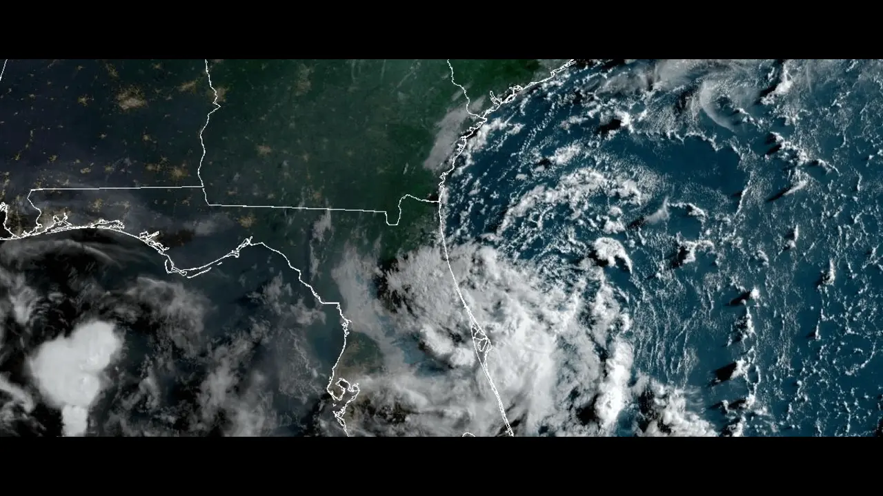
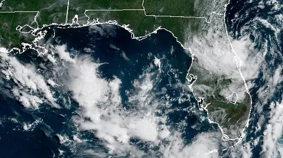
This system emerged just east of the Florida Peninsula and is moving slowly toward the west or west-northwest. Warm sea surface temperatures and moist atmospheric conditions in the Gulf could provide fuel for intensification.
NHC’s Forecast and Probability
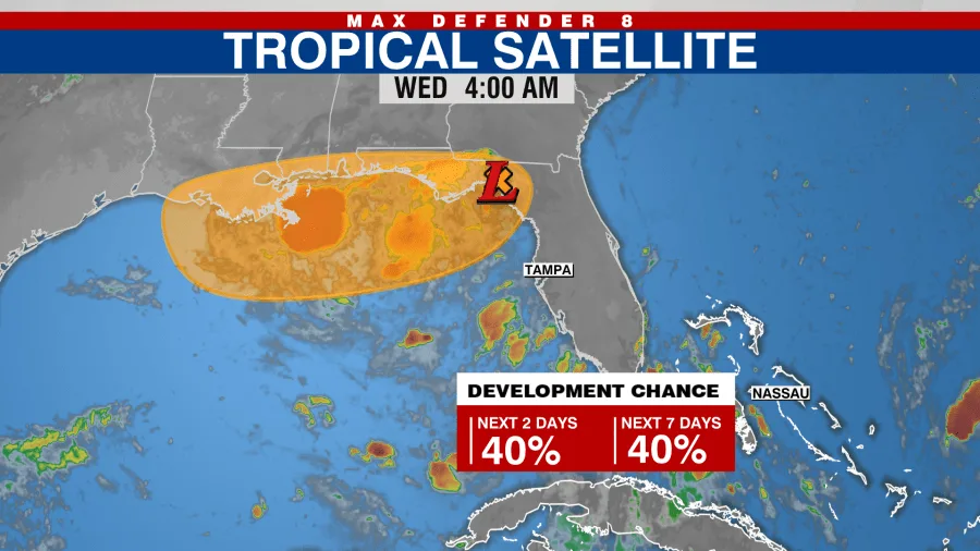
The NHC currently gives Invest 93L a 50% chance of tropical development over the next seven days. While short-term development is less likely, conditions are expected to become more favourable as the system approaches the Gulf by late week.
The center of activity is not yet well-organised, but satellite imagery and surface data suggest that gradual development is possible. As of now, wind shear and dry air pockets are somewhat limiting factors, but these may decrease later this week.
Why the Gulf of Mexico Is a Concern
The Gulf of Mexico is known for being a hotbed for tropical development, especially in the later part of July and into August. With sea surface temperatures currently well above 80°F (27°C), there’s ample energy available for Invest 93L to strengthen, should it find an environment with low wind shear and abundant moisture.
The Gulf Coast region, including states like Florida, Alabama, Mississippi, Louisiana, and Texas, must be cautious and monitor daily updates. Even if the system doesn’t become a named storm, heavy rainfall, gusty winds, and localised flooding could still occur.
Potential Impacts of Invest 93L
Here are seven critical warnings and potential impacts from the system:
- Heavy Rainfall in Florida and the Gulf States
Localized flash flooding could be a concern, especially in urban and low-lying areas. - Gusty Winds
Though not expected to reach hurricane strength soon, winds could still impact power lines and trees. - Disruption to Marine and Offshore Operations
Fishing, cargo shipping, and oil rig operations in the Gulf may face interruptions. - Coastal Flooding and Storm Surge Risk
If the system strengthens, it may cause minor storm surge events in coastal regions. - Travel Disruptions
Air and sea travel schedules may be affected, especially later in the week. - Emergency Preparation Required
Residents should prepare storm kits and review evacuation routes just in case. - Health and Safety Risks
Standing water from floods can lead to mosquito breeding and waterborne diseases.
What Should Residents Do Now?
While there is no immediate danger, residents across Florida and the Gulf Coast should begin early preparations. The Tropical Development Likely Off Florida is a reminder that hurricane season is active and evolving.
Here are a few practical steps to take:
- Stay informed with NHC and local weather station updates.
- Check your emergency supplies: food, water, batteries, medications.
- Ensure mobile devices are fully charged and backup power sources are ready.
- Understand local emergency procedures and evacuation zones.
How Likely Is It to Become a Named Storm?
If Invest 93L does develop further, the next name on the 2025 Atlantic Hurricane list is Emily. However, as of now, formation into a tropical storm remains uncertain. Models show different possibilities, and a lot depends on how the system interacts with its environment in the coming days.
Timeline to Watch
- Wednesday to Friday: Development chances increase, especially as it moves into the central Gulf.
- Weekend: Possible landfall scenario depending on track, with potential rainfall impact from the Florida Panhandle to Southeast Texas.
Keep in mind that early forecasts can shift significantly. The NHC will issue new updates every six hours, which are crucial to follow.
Officials Emphasize Caution, Not Panic
Emergency services in Florida have issued advisory notes but emphasised that the system is still disorganised. “Now is the time to prepare, not panic,” one official said. “We’ve seen how quickly these systems can form and shift.”
The Bigger Picture: A Busy Hurricane Season?
Meteorologists are warning that the 2025 Atlantic Hurricane Season could be above average, partly due to warmer sea temperatures and the fading El Niño effect. Systems like Invest 93L might be just the beginning.
The Tropical Development Likely Off Florida is an early indicator that residents must be ready for multiple potential storms throughout the season.
Conclusion
The National Hurricane Center’s close watch on Tropical Development Likely Off Florida through Invest 93L is a timely reminder of the unpredictable nature of tropical weather systems. While it has not yet formed into a named storm, the chance for development remains moderate, and impacts could be felt as early as the weekend.
Stay updated through official channels, avoid rumours on social media, and always be prepared. As history has shown, even weak tropical systems can bring strong impacts to coastal areas.
As we move deeper into hurricane season, being informed and ready can make all the difference.
Do follow Gulf Magazine on Instagram
Also Read – Urgent ‘do not eat’ warning: 5 Dangers of Dubai Chocolate Bar