

When disaster strikes, preparedness makes all the difference. Oman has embraced satellite technology with passion and innovation, weaving it into the very fabric of its disaster management systems. From early warning to response coordination and recovery planning, satellites are making Oman safer, more resilient, and better prepared for the future.
Enhancing Early Warning and Real Time Monitoring
In the realm of disaster preparedness, timing is everything. Oman’s use of satellites allows officials to monitor weather patterns, seismic activity, and coastal movements in real time. This ensures that precise alerts reach communities before a storm, flood, or earthquake occurs. With this timely information, governments and citizens can act quickly to protect lives and infrastructure.
Accurate Mapping and Risk Assessment
Creating detailed risk maps has never been easier thanks to satellite imagery. Oman overlays geographical data like elevation, land use, and population density onto satellite visuals to pinpoint vulnerable zones. Whether it is flood prone valleys or earthquake sensitive fault lines, planners gain an understanding of where and how disasters may strike, enabling more effective mitigation strategies.
Streamlined Response Coordination
When disasters do happen, rapid coordination saves lives. Satellite connectivity empowers emergency res ponders to get real time situational awareness even in areas where traditional networks are down. Teams on the ground can transmit live imagery, coordinate rescues, and manage logistics through satellite based communication systems making relief efforts faster and more organised.
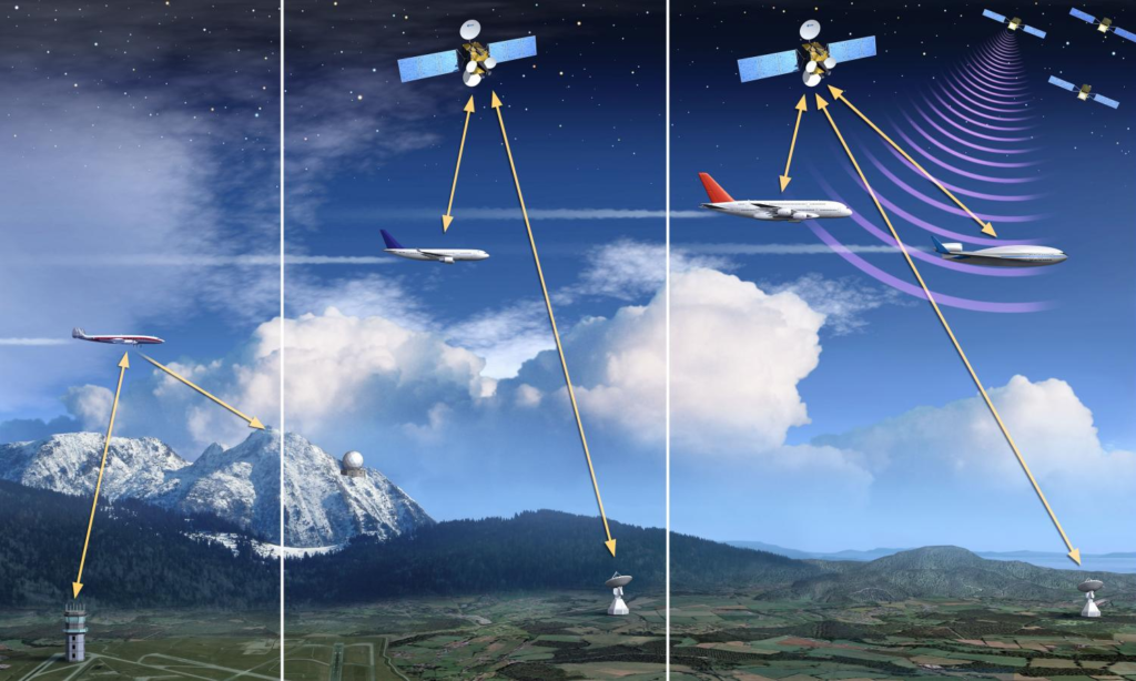
Satellite Technology :Post Disaster Damage Assessment
After a disaster, one of the biggest challenges is understanding the scale of damage. Satellites step in by capturing before and after images of affected regions. These visuals allow teams to assess infrastructure damage, identify inaccessible roads, and prioritise relief zones. This clarity speeds up recovery planning and helps authorities deploy resources where they are needed most.
Supporting Coastal and Environmental Monitoring
Oman’s long coastline brings unique natural challenges from rising sea levels to coastal erosion and hazardous weather at sea. Satellite based environmental monitoring offers early detection of threats like storm surges and harmful marine conditions. This empowers both coastal communities and marine industries to act proactively and stay safe.
Empowering Data Driven Planning
The intelligence gathered from satellites does not fade with a crisis. It fuels smarter long term planning. From urban design to resource allocation, policy makers in Oman now harness satellite derived insights to design infrastructure and activity zoning that minimise disaster impact. This data driven approach ensures resilience is built into the country’s development path.
Enhancing Public Awareness and Community Engagement
Satellites are not just tools for officials, they are catalysts for awareness. By delivering timely updates and visual insights to the public, communities become educated about risks and proactive in disaster readiness. Accessible satellite visuals and alerts foster a culture where citizens are informed, engaged, and empowered to act.

Fostering Inter Agency and International Collaboration
Satellite data often transcends national borders, making it ideal for joint operations. Oman collaborates with regional partners and international space agencies to share critical information during disasters. This cooperation enhances the speed and efficiency of multinational relief efforts and strengthens diplomatic relations.
Innovation and Future Potential
Oman’s commitment to satellite powered safety is just beginning. The country is exploring the integration of AI driven satellite analytics, drone coordination, and real time imaging to further elevate disaster response. By investing in emerging technologies and training a skilled workforce, Oman positions itself as a leader in modern resilience.
Human Stories Safety in Action
Behind every image and dataset are people whose lives are safeguarded. Satellite alerts have led to timely evacuations during storms, protecting families in vulnerable coastal villages. Rescue teams equipped with satellite connectivity have found and aided those stranded in remote areas. Communities that once felt isolated now receive alerts and support, building trust in the system and hope for the future.
Conclusion
Oman’s embrace of satellite technology is more than an upgrade to disaster management. It is a transformation. Across early warning, mapping, response, recovery, and community engagement, satellites lend clarity, speed, and purpose. This modern approach humanises disaster preparedness, creating a safer horizon where every citizen, planner, and first responded is empowered to act. As Oman continues to innovate, its satellite driven systems stand as a beacon of resilience and progress in the face of uncertainty.
Do follow Gulf Magazine on Instagram.
Also Read – Ecommerce Growth Fuelled by Advanced Logistics Technology in Oman